By Ben Goldwyn (Work Group 2020)
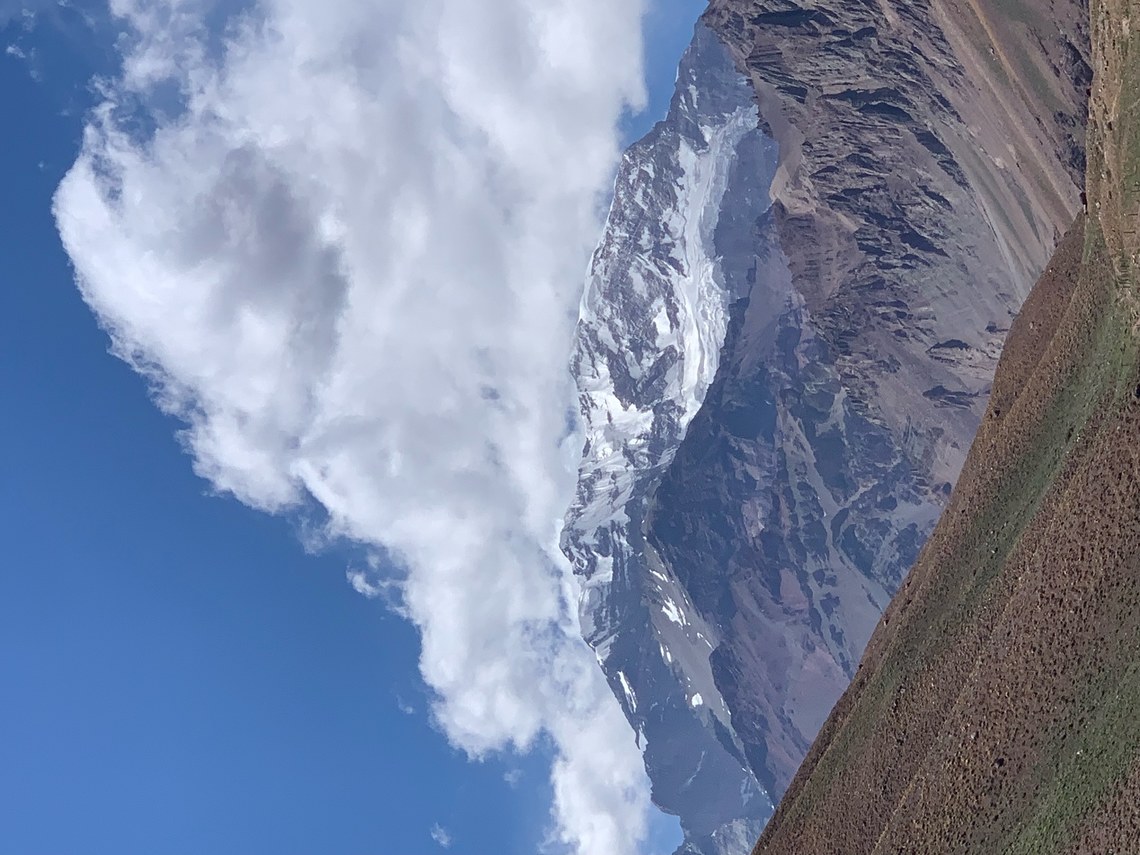
On the day before my 18th birthday this past December, I flew to Mendoza, Argentina with the goal of climbing Cerro Aconcagua. Aconcagua is a semi-pyramidal mountain composed of a sheer, rocky west face and a large, equally steep south face. The Polish Glacier sits atop cliffs to the northeast. Just over the crest of the gentle north ridge lies the significantly more gradual northwestern slopes, home to Aconcagua’s “Ruta Normal”, my chosen route. While the mountain’s other faces and ridges hold more technical and inspiring lines, Ruta Normal was my only rational choice as I was attempting the climb alone. It was fully snow-covered this year, so there was no danger of a crevasse fall. All other routes would necessitate traveling unroped on a glacier or heavily exposed terrain.
After a busy day and a half of preparation in Mendoza and a 3 hour bus ride into the Andes, the route began with a 15 mile hike through the Horcones Valley along rock and dirt mule paths to reach basecamp - Plaza de Mulas. I brought about 155 lbs of gear –110 on mules and 45 in my pack. I planned for up to 3 weeks on the mountain, so most of the mules’ weight was food and fuel, as well as comfort items and extra layers. In retrospect, I realize I drastically overestimated my needs for both. Despite using a 3 lb tent, my kit weighed over 30 pounds before adding food, water, and fuel. This was partially due to budgetary constraints; I generally used less than ultralight layers, as well as a single wall tent. Consequently, I needed a heavier synthetic sleeping bag to protect against condensation. I also felt a true ultralight/minimalist style could potentially jeopardize a summit attempt due to inadequate preparation for variable weather.
After arriving at Plaza de Mulas (~14,400ft) on the second day of my climb, I took a rest day to acclimatize in the massive tent city lying in the shadow of Aconcagua’s west face. The next day I carried a cache of food and gear for the upper mountain to Camp 1, Plaza Canada (~16,500ft), and descended again. That afternoon I met another solo climber in basecamp, and the next morning climbed with him to a few hundred feet below Camp 2, Nido de Condores (~18,250ft). He dropped his gear cache, and we turned back 30 minutes shy of the camp as storms descended on the mountain.
Over the next 2 days, clouds shrouded the upper slopes, with a few feet of snow falling on the higher camps. I waited in basecamp for a good weather window. On December 26th, my 7th day in the park, the forecast showed a 2 day summit window on the 28th and 29th, with huge storms rolling in the following week. Initially, I had planned on using 14 days to summit, spending nights at Camps 1 and 2 before moving to high camp at 19,600 ft the day before my summit attempt. However, in order to catch the window, I decided to climb directly to Camp 2 and instead of moving to Camp 3, I would rest for a day, and try to reach the summit directly from Camp 2 with an early start. This was a large shift from the speed and style I had initially planned on, and significantly more risky. I would be pushing well outside of the recommended rate of ascent, and would be adding over 1 mile and nearly 3,000 feet of elevation change to an already brutal summit day. I was confident in my acclimatization at Camp 2, but had concerns about pushing so high so fast without partners, as the choice to continue or abandon the summit bid would be left solely to my (hypoxic) self as I managed time, weather, and personal condition throughout the climb. A bad decision to continue could quickly lead to potentially serious consequences.
The altitude and weather on Aconcagua is truly extreme. The summit is the highest point in the world outside of the Himalaya, and it is incredibly prominent from the surrounding mountains, towering thousands of feet above the next highest peak within 50 miles. As a result, the upper mountain has its own highly variable weather patterns and, while they can be forecasted, precipitation and wind speed predictions are by no means a complete assessment of the conditions one might face. Nevertheless, the forecast showed wind speeds of under 15 mph on the summit through the late afternoon, and snowfall starting in the afternoon that would carry on throughout the night above Camp 2. While the potential whiteout conditions concerned me, the predicted light winds were comforting and would make the weather manageable, so long as I was descending by early afternoon. I reviewed the weather and risk factors with park rangers and guides I had befriended and then, around 4 pm on the 28th, I resolved to climb the next morning.
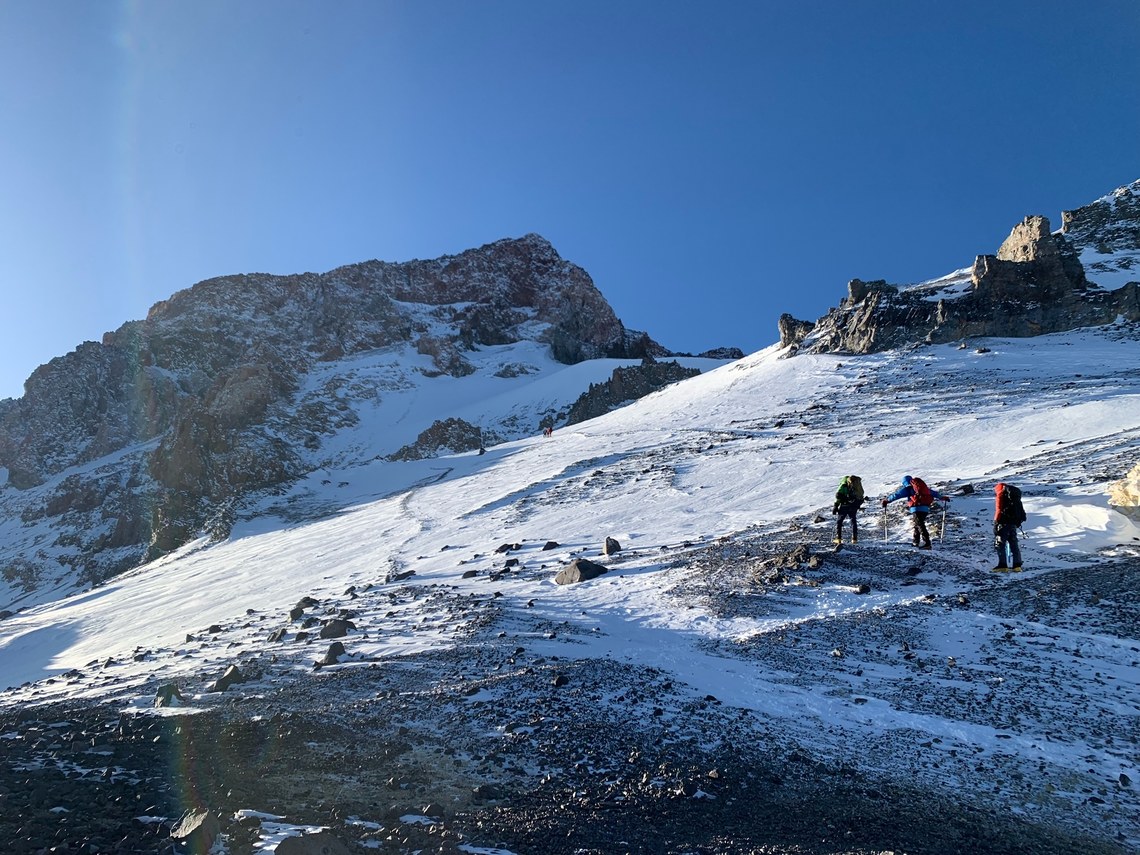
At 2:30 AM on the 29th I gathered my equipment, layered up, and forced my feet into frozen double boots. I messaged my parents on a satellite communicator, and at 3:15 headed out into the night. The climb from Nido to the summit consists of 4 notable sections: a gentle gully leading 1,500 feet up to Colera (Camp 3); the rockfields of Piedras Blancas and Piedras Negras; La Travesía, a traverse with the only real exposure on the route; and finally, the Canaleta, a steep snow and rock couloir leading to the summit.
After 2 hours, I reached Colera just as the sun hit the pale rocks above the camp. Seeing a few small groups on the slopes ahead of me, I pushed along the winding path through the rockfields. By 9 am I passed several guided groups. They would all turn back short of the Canaleta. After exiting the rockfields, I gained a ridge leading onto the traverse, and began following the boot track across the top of a broad, tall slope. While the exposure wasn’t too extreme (the incline was at most 45 degrees) the slopes were riddled with rocks. It was a place I could not afford to fall. I took nearly 3 hours to travel about half a mile with 800 ft of elevation gain, a definite indication of my poor acclimatization.
At the top of the traverse lies La Cueva, a sheltered area under overhanging rock sitting just 1,000 feet below the summit. I arrived there at 12:30. This was later than I preferred, but I had been moving sluggishly for hours so all things considered, I was pleased. I hoped to make a 2 hour round trip to the summit from La Cueva. That would have positioned me to descend the traverse and find the correct gully back toward Colera before the navigation became complicated by the impending snow, which would impair the visibility and obscure the boot tracks. Shortly after starting up the steep and snowy rocks of the Canaleta, the shoulder of the summit became visible, seemingly just minutes away. To my surprise, when I looked at my watch, I realized I was already an hour out from La Cueva, and not even halfway to the top of the couloir, with a short scramble along the summit ridge still lying above.
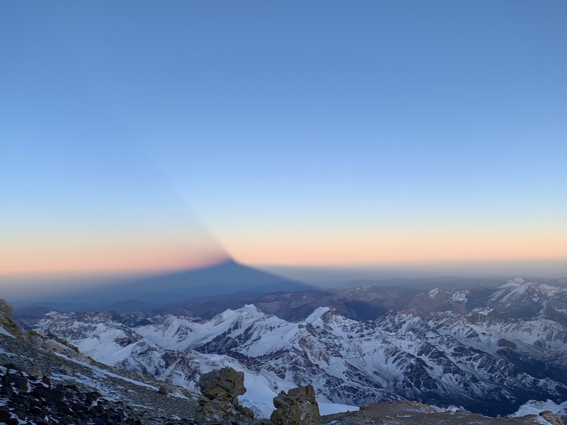
At this point I was struggling to move for even 30 seconds without stopping. After 2 hours I was nearing the summit ridge–in that time I had climbed 500 ft over 2/10ths of a mile, with almost 400 ft to go over the last 1/10th of a mile. I realized my pace would bring me to the summit well after 3:00, but until that point the weather had been good with almost no wind. Nevertheless, it was much later in the day than I had planned. The lack of wind actually turned out to be an issue for the final push from the upper Canaleta. The clouds parted, exposing me to the brutally strong sun and forcing me to shed layers and gloves to keep from overheating, despite the ambient air temperature being below -20 F. A final steep rock scramble brought me to the summit at 3:30 pm, after more than 12 hours of climbing. On the summit, I met another pair of climbers, a woman and her guide, and following some quick photos we descended the Canaleta together.
By the time I was back at La Cueva, clouds had enveloped the upper mountain, and as I sat down to rest the other climbers continued down. I had been feeling symptoms of moderate altitude sickness for a while, and my condition had not improved even after losing 1,000 feet of elevation descending from the summit. I leaned down to throw up, and when I looked back up, I could barely see 20 feet in front of me. That was my cue to begin the descent, and as I crossed the traverse, pausing intermittently to vomit, the snow picked up, although thankfully (and crucially) the wind was still weak. As I reached the bottom of the traverse my AMS (Acute Mountain Sickness) symptoms were improving, although I still could not hold down water, and I focused my attention on finding the correct exit from the ridge. On the way up this section, I had watched from below as a climber attempted to descend the wrong gully and ended up below a cornice on steep terrain. The same mistake on the descent would be considerably more consequential, so I took care to find the right col in the ridge, signaling the proper exit before descending off the eastern slope. The remaining navigation was straightforward, although the whiteout persisted until I was below Colera. I broke out of the storm for my final hour back to Nido, and had a beautiful view of the sunset casting its light on the lower peaks to the north. I arrived back at my tent a few minutes before 9 pm. I had been out for nearly 18 hours. Two days later, back in Mendoza, I would realize the true effects of the exposure when I saw my burned face and blackened lips in the mirror.
This trip was the culmination of years of experience hiking, camping, and gaining confidence in the backcountry. For me, all of that started at Camp Lincoln. I came to camp as a younger Cub with almost no experience backpacking or camping. Throughout my first three summers I went on trips, but it wasn’t until my older junior year that I developed a real interest in hiking the high peaks. That summer I went on the JBL extended trip, and I was an avid hiker from that point onward.
The skills I learned and developed on camp trips are the basis for everything I do in the outdoors now. From a young age, kids are encouraged to take responsibility for, at a minimum, handling themselves well in the backcountry. Gear and food is always split up evenly, everyone is responsible for their own layering decisions, and establishing and maintaining a campsite is a group effort. Counselors provide guidance and oversight, ensuring everyone has the correct equipment and is taking care of themselves, but instruction is always constructive–I always understood why I was doing something on a trip. This ability to gain insight into a trip leader’s decision-making helped me develop my own sense of judgment, even in a supervised environment, as I could compare my thought process to the counselors’, and observe how my (and their) perception of certain situations played out versus reality.
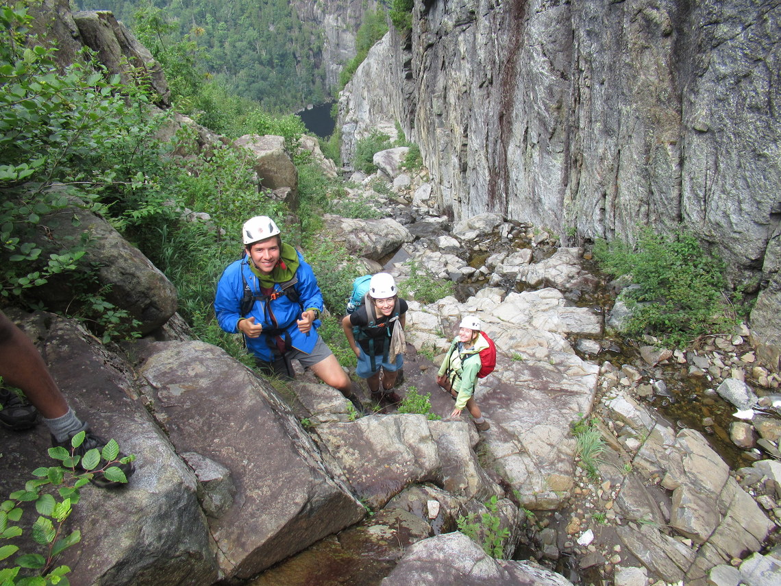
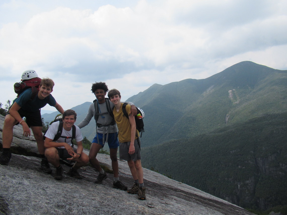
Ben Goldwyn (far left) - Colden trap dike
Because of this culture of outdoor competency, I have seen high altitude climbers with less will and ability to function autonomously than some campers at Lincoln. Any camper who has been on a few trips does not need to be told how to handle layering, nutrition, and hydration (something I have seen happen between many guides and their clients). As I got older and gained experience, I was given the opportunity to go on trips where campers were able to take the lead–navigating off-trail and managing time, breaks, and conditions–while also receiving invaluable guidance and insight from some incredibly skilled staff members. These trips were essential to developing the critical and objective decision-making abilities required to safely travel and challenge myself independently in the backcountry. Without camp, I likely never would have gone for a solo hike at this point in my life, much less gone down the road of big mountain climbing. I am from Washington, D.C., a place with barely any hills. Camp was my gateway to the outdoors, and it was the place I learned the most fundamental and important skills required for any adventure. I would not be the person I am today without the experiences I had at NCC.
Ben Goldwyn (second from left) - Colden trap dike